
Section 3: Winds & Water
Air is a fluid, which means it can flow easily from place to place. Differences in air pressure cause air to move. Wind is the movement of air from areas of high pressure to areas of low pressure. High-pressure areas contain cooler, denser air that sinks toward Earth’s surface. Low-pressure areas contain warmer, less dense air that rises. As warm air rises, cooler air moves in to replace it, creating the movement of air we feel as wind.
Some winds affect only small areas. Local winds blow over short distances and form when land and water heat unevenly. For example, land may heat up faster than nearby water, creating a sea breeze. Because these winds form from small temperature differences, they usually affect only a limited area.
Other winds travel much farther. Global winds blow steadily over long distances and form when Earth’s surface is heated unevenly on a much larger scale. The movement of air between the equator and the poles produces these global wind patterns.
 The three major global wind belts are the trade winds, prevailing westerlies, and polar easterlies. Their locations on Earth are shown in Figure 1. Because Earth rotates, global winds do not move in straight lines across the planet. Instead, their paths curve because of the Coriolis effect, which is the apparent bending of moving air caused by Earth’s rotation. As a result, winds in the Northern Hemisphere curve to the right, while winds in the Southern Hemisphere curve to the left.
These curved wind patterns create several major global wind belts, each located in a different region of Earth. Trade winds blow from east to west between about 30° north latitude and 30° south latitude, moving toward the equator. Prevailing westerlies blow from west to east between about 30° and 60° latitude in both hemispheres. Near the poles, polar easterlies are cold winds that blow from east to west.
High above these wind belts are powerful air currents called jet streams. Jet streams form near the top of the troposphere and usually flow from west to east. These fast-moving winds can influence weather patterns by steering storms and air masses around the planet.
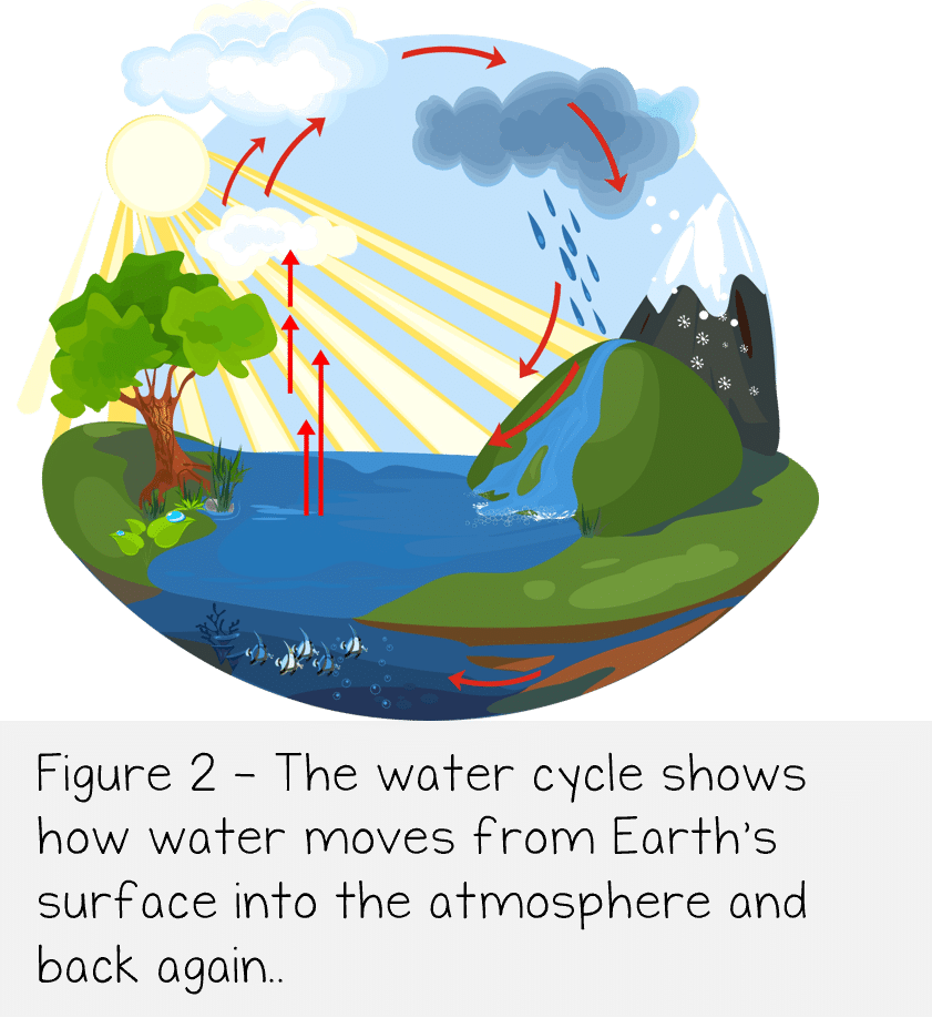 Water is constantly moving between Earth’s surface and the atmosphere as part of the water cycle. As water evaporates from oceans, lakes, rivers, and other surfaces, it enters the atmosphere as water vapor, an invisible gas. The amount of water vapor in the air can vary with temperature. Relative humidity describes how much water vapor is in the air compared to the maximum amount the air can hold at a specific temperature. Warm air can hold more water vapor than cold air, so relative humidity often changes as temperature changes. As air cools, it becomes less able to hold water vapor. The dew point is the temperature at which air becomes fully saturated with water vapor. When the air cools to the dew point, water vapor condenses into tiny droplets of liquid water or ice crystals. This condensation leads to the formation of clouds. Scientists classify clouds based on their shape and altitude, or height in the atmosphere.
High-level clouds form at high altitudes where temperatures are very cold, so they are mostly made of ice crystals.
- Cirrus – Thin, wispy clouds that often look like feathers. They usually indicate fair weather, but they can also signal that the weather may change soon.
- Cirrostratus – Thin, sheet-like clouds that often cover much of the sky and can create a halo around the Sun or Moon.
- Cirrocumulus – Small, white, puffy clouds that appear in rows or ripples
Mid-level clouds form at middle altitudes and are made of water droplets or a mix of water droplets and ice crystals.
- Altocumulus – Puffy clouds that appear in patches or layers. They often signal changing weather.
- Altostratus – Gray or blue-gray clouds that spread across the sky and can block or dim sunlight. They often form ahead of storms.
Low-level clouds form closer to Earth’s surface and are mostly made of liquid water droplets.
- Stratus – Flat, gray clouds that cover the sky like a blanket and may bring light rain or drizzle.
- Stratocumulus – Low, puffy clouds that form layers or rows. They usually bring cloudy skies but little precipitation.
- Nimbostratus – Thick, dark clouds that produce steady rain or snow over long periods.
Some clouds grow vertically through many layers of the atmosphere.
- Cumulus – Puffy, cotton-like clouds with flat bases and rounded tops. They usually indicate fair weather.
- Cumulonimbus – Tall, towering clouds that can produce thunderstorms, heavy rain, lightning, hail, and strong winds.

Sometimes the droplets or ice crystals in clouds grow large and heavy enough to fall to Earth. This falling water is called precipitation, which is water in either liquid or solid form that falls from the atmosphere. Common types of precipitation include rain, sleet, freezing rain, snow, and hail.
Review:
- What are the characteristics of local winds?
- What is a jet stream?
- How do clouds form?