Section 2: Models of Earth
Maps are extremely useful in our world. Maps show us what places look like, where they’re located, and the distance it takes to travel from location to location. A map is a flat model of all or part of Earth’s surface as seen from above. Because Earth is round, a globe is often used to accurately depict the entire surface. While a globe shows Earth’s true shape, maps are easier to carry, fold, and use.
Both maps and globes are drawn to scale, which means the distances on them are proportional to the real distances on Earth. For example, one inch on a map might represent 100 miles in real life. Many maps include a scale bar, which allows you to measure distances directly. Using the scale, you can calculate the distance between two cities.
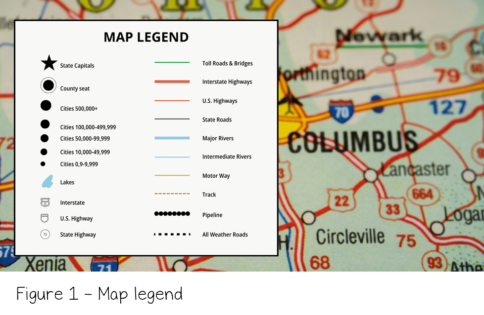 Although maps are small, they contain a great deal of information. To fit all of this information into a limited space, mapmakers use symbols to represent features on Earth’s surface. These symbols may stand for physical features, such as rivers or mountains, or artificial (human-made) features, such as roads or buildings. Symbols can be simple shapes, lines, or small pictures. To help readers understand what each symbol means, maps include a key (or legend) that explains the symbols used.
To further organize information, maps and globes use a system of grid lines. Because Earth is a sphere, these lines often appear curved. Two important reference lines form the basis of this grid system: the equator and the prime meridian. The equator is an imaginary line halfway between the North and South Poles. It divides Earth into the Northern and Southern Hemispheres. The prime meridian is another imaginary line that runs from the North Pole to the South Pole and divides Earth into the Eastern and Western Hemispheres.
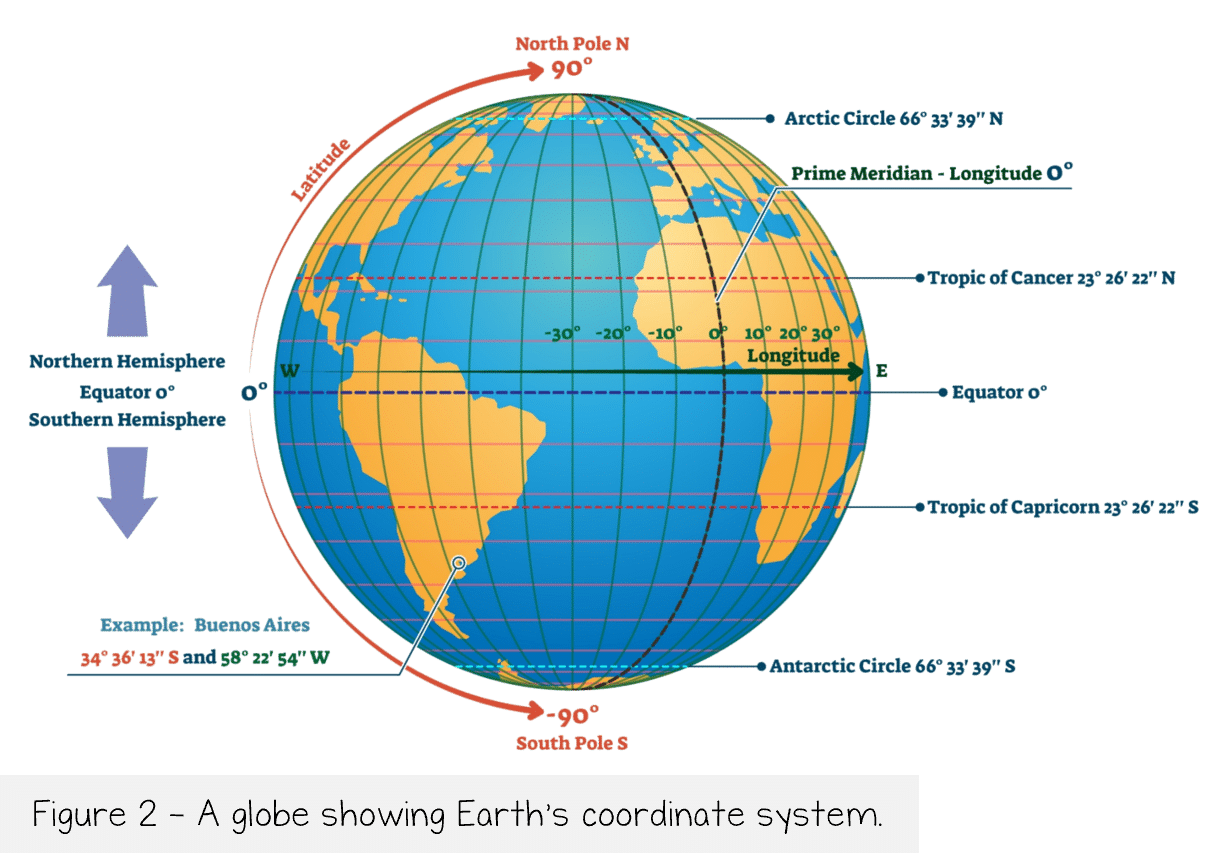 Locations on Earth are measured in degrees, with a full circle containing 360 degrees. These degrees are used in the system of latitude and longitude. Latitude measures distance in degrees north or south of the equator. Lines of latitude run parallel to the equator. Longitude measures distance in degrees east or west of the prime meridian. Lines of longitude run from pole to pole. When a line of latitude crosses a line of longitude, they form a set of coordinates that pinpoint an exact location on Earth’s surface. For example, New York City can be located using its specific latitude and longitude coordinates.
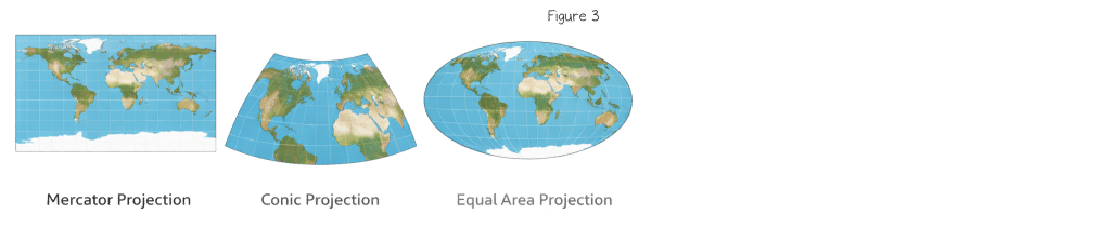
A map projection shows the curved Earth on a flat map. It’s a framework of lines that helps transfer points on Earth’s three-dimensional surface onto a flat map. There are three types of projections. The Mercator projection is where the lines are straight, and the land near the poles is distorted. An equal-area projection distorts shapes around the edges of a map. Finally, a conic projection uses straight lines for the longitude and curved lines for the latitude.
Because Earth is curved, representing it on a flat surface creates challenges. To solve this problem, cartographers (mapmakers) use a map projection, which is a method for projecting Earth’s three-dimensional surface onto a two-dimensional map. However, every projection introduces some distortion.
There are several main types of projections. The Mercator projection uses straight lines for latitude and longitude, which makes navigation easier. However, it greatly enlarges areas near the poles, making places like Greenland appear much larger than they actually are. A conic projection uses straight lines for longitude and curved lines for latitude. It works well for showing regions in the middle latitudes, such as the United States. An equal-area projection preserves the area of landmasses but distorts their shapes, especially near the edges of the map.
Review:
- Explain the difference between a map and a globe.
- Where would you find the equator on a map? Where would you find the prime meridian?
- What is a map projection?