Related products

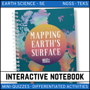

Mapping Earth’s Surface: Maps, Models & Topographic Maps Unit | MS Earth Science
$35.94
Click here to download a preview of Mapping Earth's Surface unit.
This unit is included in the Earth Science Curriculum 5E Model.
Teach maps, models of Earth, latitude/longitude, and topographic mapping with this comprehensive Mapping Earth’s Surface Unit designed for middle school Earth science.
This complete unit includes full lessons, notes, interactive notebooks, labs, quizzes, stations, task cards, word walls, QR code access to online text, and assessments—everything you need for a zero-prep, high-engagement mapping unit.
Perfect for grades 6–8, this resource helps students master map skills, contour lines, elevation, digital mapping, GIS concepts, and how scientists represent Earth’s surface.
Aligned to NGSS Middle School Earth Science (MS-ESS2) for Earth’s systems, mapping Earth’s surface, and interpreting geoscience data.
⭐ What’s Included
- PowerPoints for:
- Mapping Earth’s Surface
- Models of Earth
- Maps & Computers
- Student Notes (print + digital)
- Interactive Notebook Activities (print + digital)
- Mini-Quizzes + Digital Assessments
- Teacher Demo: An Imaginary Grid
- Guided Inquiry Lab: Topographic Mapping
- Science Stations (STEM Challenge Included)
- Task Cards (print + digital)
- Study Guide
- Final Chapter Assessment
- Word Wall in English & Spanish (included in all formats)
- QR Codes for students to access a free online textbook
- 9-day pacing guide
- Answer keys included for all components
⭐ Key Concepts Covered
- Latitude, longitude & coordinate systems
- Map scales, symbols & legends
- Models of Earth: globes, maps, projections
- Relief, elevation & contour intervals
- Reading topographic maps
- Identifying landforms using contour lines
- Digital mapping & computer-based map tools
- GIS and remote-sensing basics
⭐ Why Teachers Love This Unit
- Highly visual explanations of maps and topography
- Hands-on lab allows students to build & interpret topo maps
- Zero prep — lessons, assessments, stations & vocab supports included
- Word Wall in English & Spanish supports ELLs and mixed classrooms
- QR codes make content accessible for students on any device
- Perfectly aligned with NGSS Earth science mapping skills
⭐ Ideal For
- Middle school Earth science
- Map skills and data interpretation
- Topographic maps
- Latitude/longitude lessons
- NGSS MS-ESS2
- Interactive notebook classrooms
- Stations-based or blended learning
⭐ Suggested Pacing Guide – Mapping Earth’s Surface (9 Days)
Day 1: Teacher Demo – An Imaginary Grid; Section 1 PowerPoint/Notes/INB
Day 2: Section 1 Mini-Quiz; Section 2 PowerPoint/Notes/INB
Day 3: Section 2 Mini-Quiz; Guided Inquiry Lab – Topographic Mapping
Day 4: Section 3 PowerPoint/Notes/INB
Day 5: Section 3 Mini-Quiz; Science Stations
Day 6: Science Stations
Day 7: Creation Station Final Draft + Testing
Day 8: Task Cards + Study Guide
Day 9: Chapter Assessment
Copyright © NGS Magnified, LLC. All rights reserved by author Dr. Erica Colón. All NGS Magnified curriculum is creative property of Erica Colón and cannot be resold or distributed. This product is to be used by the original downloader only. Copying for more than one teacher, classroom, department, school, or school system is prohibited. This product may not be distributed or displayed digitally for public view. Failure to comply is a copyright infringement and a violation of the Digital Millennium Copyright Act (DMCA). Clipart and elements found in this PDF are copyrighted and cannot be extracted and used outside of this file without permission or license. Intended for classroom and personal use ONLY.
Only logged in customers who have purchased this product may leave a review.
Reviews